Adventure · Hiking · Photography
San Gorgonio Wilderness: The Ultimate Guide to Hiking, Backpacking & Photography
Southern California's highest peak. Its most demanding trails. Its most rewarding views. Here's everything you need to know before you go.
An hour east of Los Angeles, tucked behind the sprawl of the Inland Empire, sits one of the most extraordinary wilderness areas in all of California. The San Gorgonio Wilderness — anchored by San Gorgonio Mountain at 11,503 feet — is the rooftop of Southern California. And if you've never been up there, you're missing one of the most dramatic, humbling, and genuinely beautiful landscapes this region has to offer.
I've hiked and photographed in this wilderness more times than I can count. Every trip changes depending on the season, the light, and the weather moving in off the Pacific. It never gets old. This guide covers everything you need — the trails, the permits, what to pack, the best photography windows, and what to expect when you get up high enough that the city below disappears entirely.
Why San Gorgonio Wilderness?
There are plenty of beautiful places to hike in Southern California. But San Gorgonio is different. It's not a casual nature walk — it demands something from you. The trails are long, the elevation gain is serious, and the alpine environment above 10,000 feet operates by its own rules regardless of what's happening in the valley below.
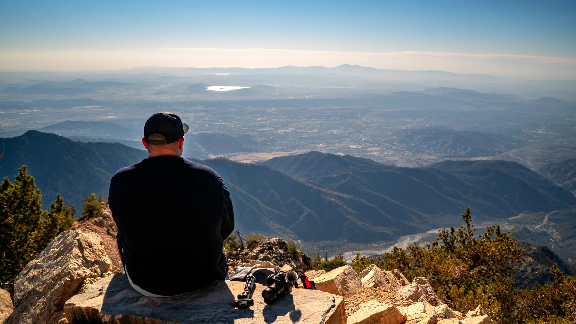
That challenge is exactly what makes it worth it. The wilderness area protects nearly 35,000 acres of pristine Southern California backcountry — subalpine meadows, lodgepole pine forests, granite boulder fields, and the sweeping open ridgelines that define the summit zone. On a clear day from the top of San Gorgonio, you can see the Pacific Ocean, the Salton Sea, the Mojave Desert, and the Channel Islands — all at once. There is no view like it in Southern California.
"The summit of San Gorgonio puts everything in perspective. You're standing above the smog, above the noise, above the city — looking out at the whole of Southern California laid out below you like a map."
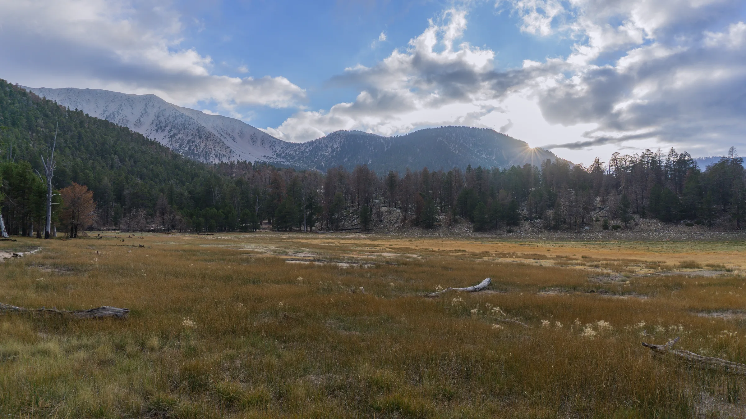
The scale of the San Gorgonio Wilderness doesn't hit you until you're standing in it.
The Trails: Which Route Is Right for You?
The San Gorgonio Wilderness has multiple approach routes to the summit and plenty of excellent non-summit destinations. Here are the main options:
Vivian Creek Trail — The Classic Summit Route
The most popular and arguably most beautiful route to the summit. The trailhead starts at 6,800 feet near Mill Creek, and the round-trip distance is approximately 16.5 miles with 4,900 feet of elevation gain. The trail climbs through a lush riparian canyon, opens into High Creek Camp (a popular backpacking stop), and then ascends the final exposed ridgeline to the summit. This is a serious day hike — start before dawn.
South Fork Trail
A longer but more gradual approach from the south, the South Fork Trail is 18+ miles round trip from the South Fork Meadows trailhead. The lower sections pass through open chaparral and manzanita before entering the pine zone. A favorite for backpackers who want to camp at Dry Lake or Lodgepole Meadow and summit on day two.
Momyer Creek / Angelus Oaks Route
Less traveled and wonderfully quiet. This route approaches from the north through Angelus Oaks and offers solitude even on busy summer weekends. The forest is dense and beautiful, and the gradient is steady without the steep rock sections found on Vivian Creek's upper push.
Dollar Lake & Fish Creek — Backpacking Destinations
Not every trip needs to be a summit bid. Dollar Lake, nestled in a granite bowl below the summit ridge, is one of the most scenic backpacking destinations in the San Bernardino Mountains. Fish Creek Meadows is equally spectacular in late spring when the wildflowers bloom across the high meadow floor.
Before You Go: Trail Essentials
- Wilderness permit required — Day and overnight permits are mandatory. Reserve in advance at Recreation.gov
- Start early — Afternoon thunderstorms are common in summer. Be off exposed ridges by noon
- Water sources — High Creek and several springs en route are usually reliable; always filter or treat
- Snow season — The summit can hold snow into June and see early storms in October. Check conditions before going
- Leave No Trace — Pack out everything. This wilderness stays pristine because hikers treat it that way
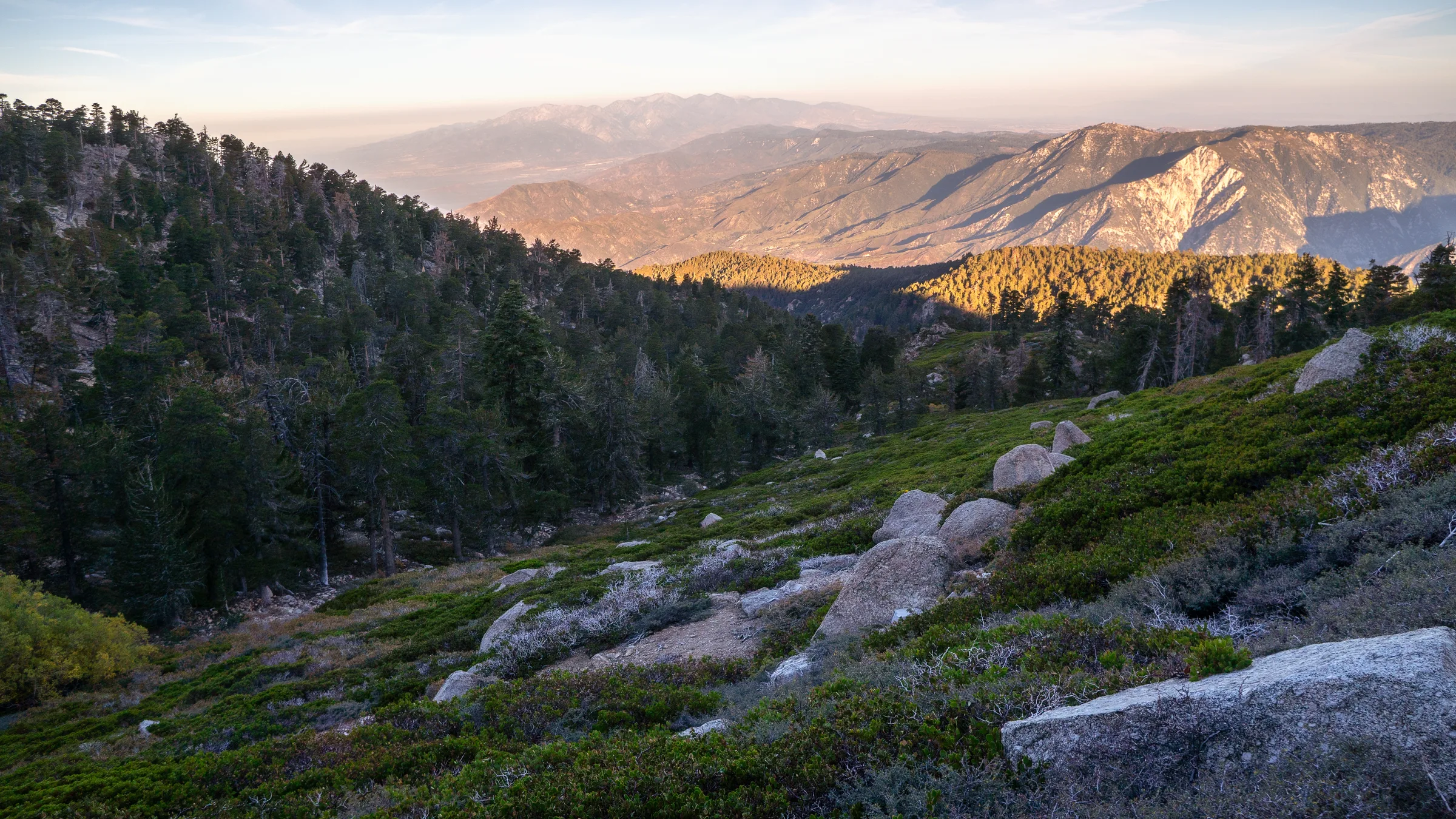
The light that hits the San Bernardino Mountains at golden hour is unlike anything else in Southern California.
Backpacking in the San Gorgonio Wilderness
If a summit day hike sounds like too much to bite off in one go, backpacking is the answer. Breaking the trip into two days completely changes the experience — you get the quiet of the wilderness at night, the deep cold of a high-altitude morning, and you're positioned to summit at first light before any crowds arrive.
Best Backpacking Camps
High Creek Camp sits at around 9,000 feet on the Vivian Creek route and is the most popular overnight stop for summit-bound backpackers. A reliable water source, good wind protection, and a short push to the summit the next morning make it the go-to first camp.
Dry Lake, accessed from the South Fork Trail, is a large open basin with expansive views and multiple established camping areas. The lake is often dry by late summer but the setting — open meadow surrounded by peaks — is stunning at any time of year.
Dollar Lake is the most scenic overnight destination in the wilderness. Small, clear, and set against a granite backdrop below the summit ridge, it rewards the extra miles it takes to reach it.
Gear for the San Gorgonio Backcountry
The high alpine environment demands proper preparation even in summer. Temperatures drop fast after sunset at elevation, and afternoon storms can roll in with little warning. Pack layers you can actually use, not just carry:
- Sleeping bag rated to 20°F — even in July, nights above 9,000 feet can surprise you
- Wind shell and rain layer — mandatory for anyone on exposed ridges
- Trekking poles — essential on the long descents that destroy knees on unassisted trails
- Headlamp with extra batteries — pre-dawn starts are standard on summit days
- Bear canister — required for overnight stays in the wilderness
- Navigation — download offline maps before you leave cell range
Golden hour in the San Bernardino backcountry — the kind of light that makes the long approach miles worth every step.
Every season in the San Gorgonio Wilderness offers something different to photograph.
Photography in the San Gorgonio Wilderness
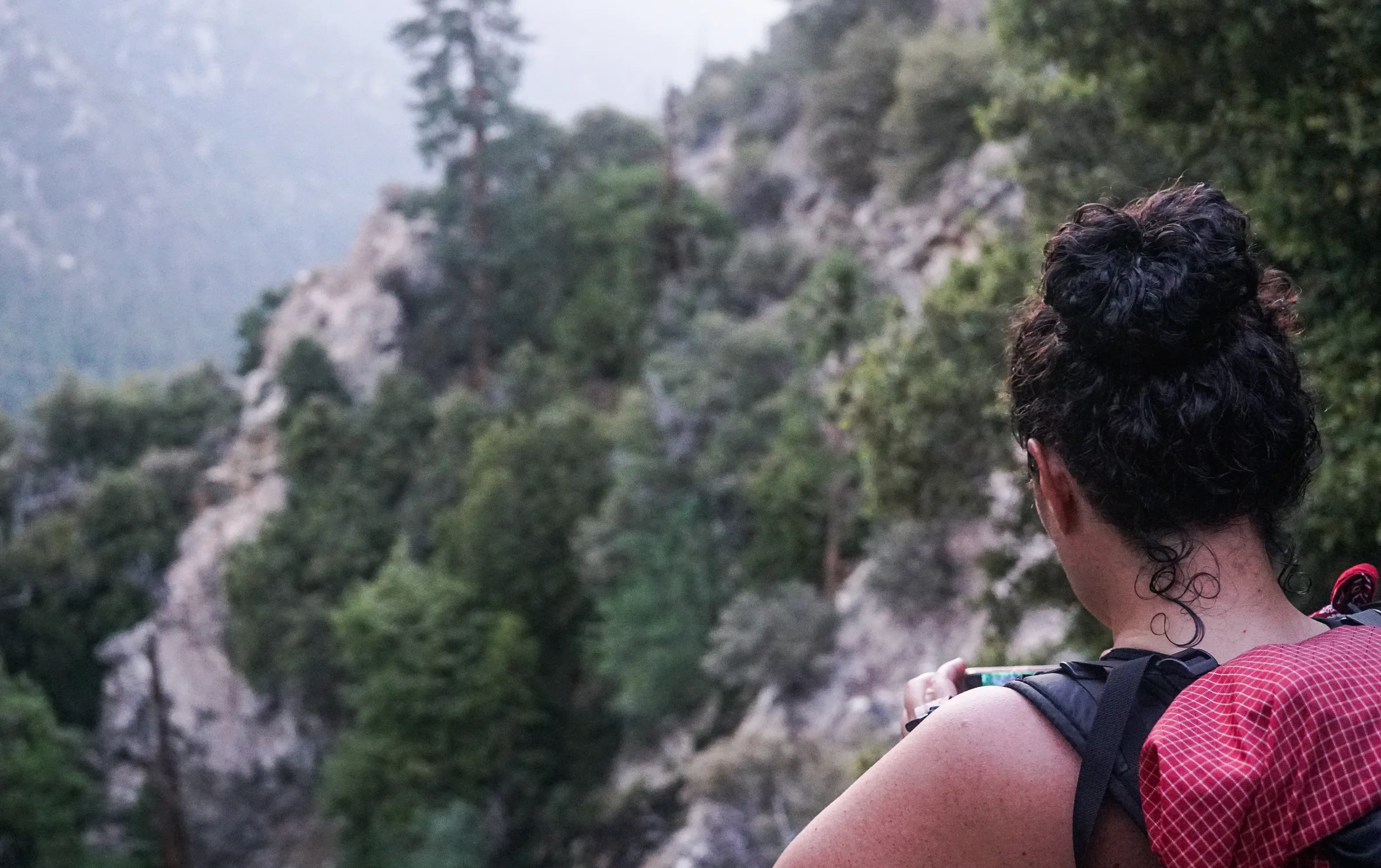
For photographers, San Gorgonio is a gift that changes every time you visit. The variety of subjects and conditions within a single wilderness area is extraordinary — from intimate forest details at low elevation to sweeping alpine vistas near the summit, with constantly shifting light to work with across every hour of the day.
Golden Hour from the Summit Ridge
If you can time a backpacking trip to be on the summit or upper ridge at sunrise, the light is otherworldly. The summit sits above the marine layer that often blankets the Los Angeles basin, so you're shooting down into a sea of clouds with the first orange light breaking across the horizon. It's the kind of shot that doesn't require a filter or heavy editing — just being in the right place at the right time.
The Forest Transition Zones
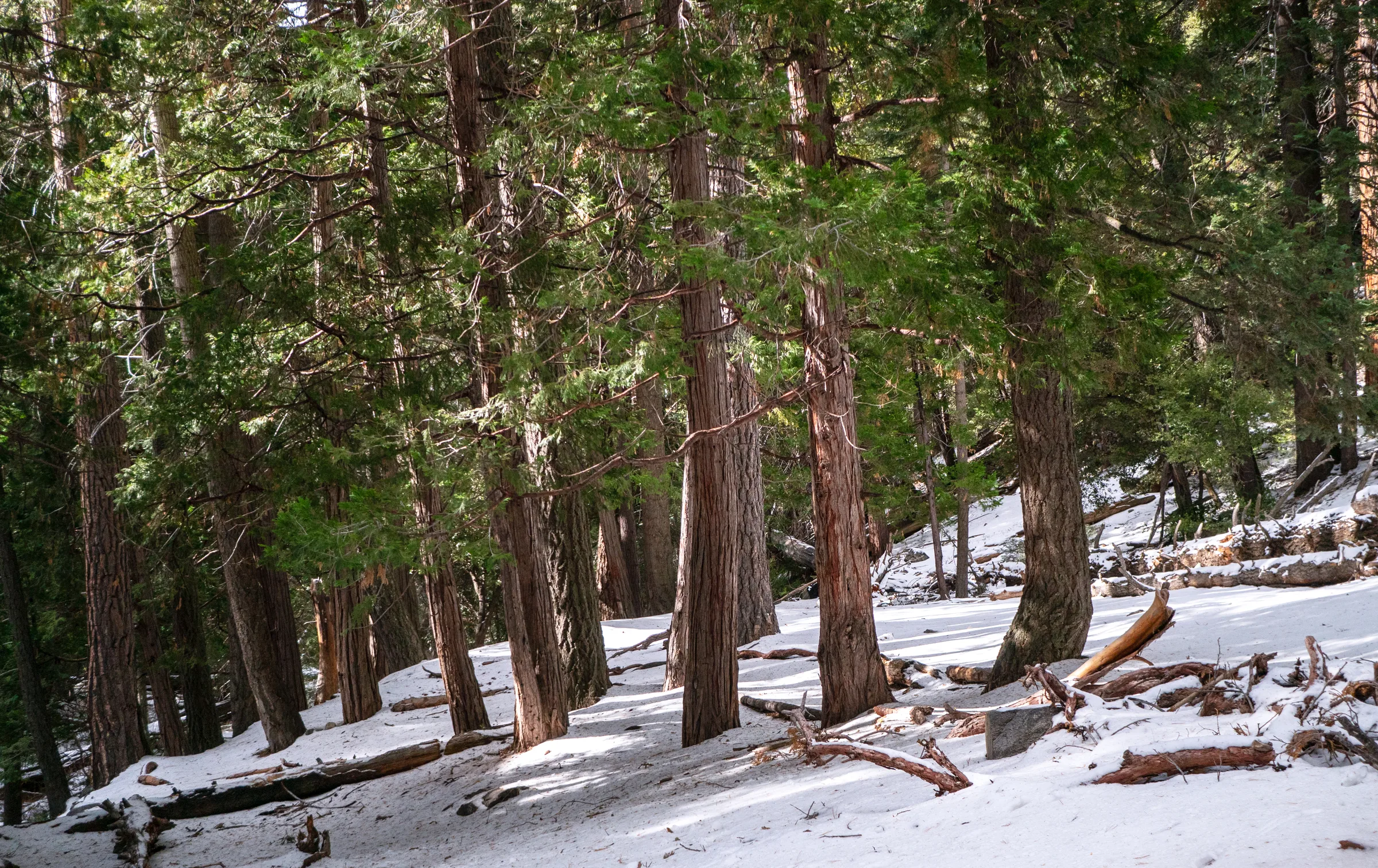
One of the most underrated photography subjects in this wilderness is the transition between ecological zones as you climb. The chaparral gives way to black oak, then to ponderosa and Jeffrey pine, then lodgepole pine, then the sparse, wind-twisted limber pines near treeline. Each zone has its own light quality, textures, and mood — and each rewards close-in detail work as much as wide landscape shooting.
Seasonal Windows
Late spring (May–June) brings snowmelt waterfalls, wildflower meadows, and dramatic contrasts between lingering snowfields and new green growth. The light is clean and long at this latitude, and the crowds haven't arrived yet.
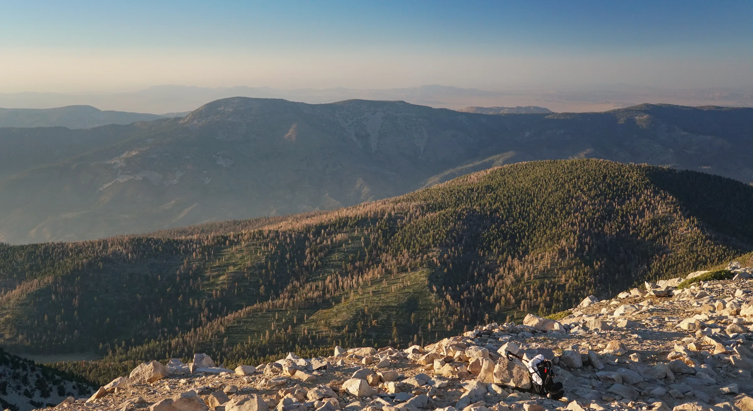
Summer (July–August) offers reliable clear mornings before afternoon convection clouds build. The air above 9,000 feet is noticeably sharper and cleaner than valley air, which makes for crisper telephoto shots of distant terrain.
Fall (September–October) is arguably the best season of all. The aspens along creek drainages turn gold and orange, the afternoon light drops lower and warmer, and the wilderness is quieter. Snow can arrive any time after September, which adds drama to landscape compositions.
Winter transforms the wilderness entirely. Access requires snowshoes or microspikes above a certain elevation, and conditions can be genuinely alpine — but the photography rewards are enormous. Fresh snow on dark granite, blue shadows across white slopes, and a silence so complete it's almost audible.
The wilderness shifts dramatically with each season — no two trips look the same.
Camera Gear for High Altitude Hiking
Everything you carry up a 16-mile trail matters. Here's how I approach the camera kit for a San Gorgonio trip:
- One body, two lenses — a wide zoom (16–35mm range) for landscapes and a mid-range prime (50mm or 85mm) for detail and portrait work. The discipline of limiting your kit forces better editorial decisions in the field.
- Extra batteries — cold temperatures at elevation drain batteries faster than you'd expect. Carry at least two fully charged spares.
- Filters — a polarizer for cutting atmospheric haze on distant ridgelines, and a 3-stop ND for long exposures on any water features you encounter.
- Peak Design or similar carry system — quick access to your camera without stopping to dig through a pack is essential when light changes fast.
- Lens cloth and blower — dust and grit are constant at elevation; protect your glass.
"The best photography happens when you're already committed to being somewhere for reasons beyond the shot. San Gorgonio teaches you that. You earn the light up there."
You earn the light up here.
Getting There & Permits
The San Gorgonio Wilderness is managed by the San Bernardino National Forest and is located roughly 90 miles east of Los Angeles, accessible from the town of Forest Falls (Vivian Creek trailhead) or from Highway 38 east of Big Bear via the South Fork and other trailheads.
Wilderness permits are required year-round for both day hikes and overnight trips. Day permits are self-issued at most trailheads outside of the quota season (typically Memorial Day through November). During quota season, advance permits are required and can be reserved at Recreation.gov. They go fast — book months ahead for summer weekends.
Quick Reference
- Nearest town: Forest Falls, CA (Vivian Creek TH) / Angelus Oaks (South Fork TH)
- Summit elevation: 11,503 ft (San Gorgonio Mountain)
- Best months: June – October for summit; year-round for lower trails
- Permit: Required — Recreation.gov
- Dogs: Allowed on leash on most trails
- Cell service: Limited to none above the trailheads
- Nearest fuel: Redlands or Yucaipa before heading up
Want photos from your San Gorgonio adventure?
Whether you're planning a summit day, a backpacking trip, or a guided photography outing in the San Bernardino Mountains, Matt Dunn Visuals is based right here in the Inland Empire and knows this wilderness well. Let's plan something.
Get in Touch
Views from the San Gorgonio Wilderness — worth every mile to get here.
Final Thoughts: Why San Gorgonio Deserves Your Time
Most Southern California residents drive past the base of the San Bernardino Mountains their entire lives without ever going up into them. That's a loss worth correcting. The San Gorgonio Wilderness is one of the most accessible true alpine environments in the contiguous United States — a short drive from tens of millions of people, and yet genuinely wild, genuinely demanding, and genuinely beautiful.
Whether you're chasing the summit, hunting for a backpacking camp above treeline, or looking for landscape photography that doesn't require a flight to get to — this wilderness delivers. Pack smart, start early, respect the environment, and go.
— Matt Dunn, Matt Dunn Visuals
Got Questions?
We Have Answers
A few of the most common questions across photography, video, design, and web.
Photography
Videography
Graphic Design
Web Design